
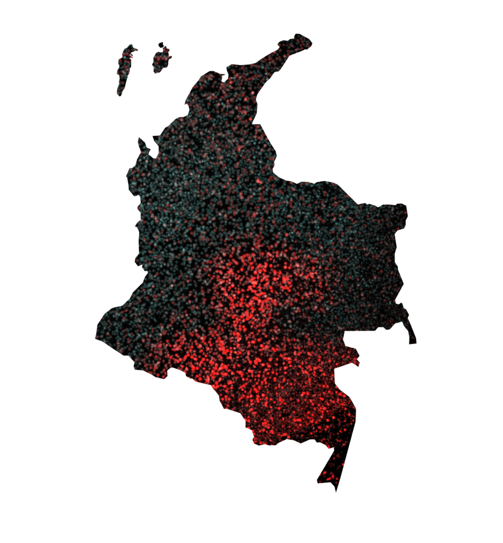
The numbers do not lie and are very worrying. In the last two decades
Colombia lost
4.716.760
hectares of forests throughout the national territory, an area so large that it exceeds the size of European countries such as Belgium, Denmark or Luxembourg. The data comes from satellite measurements carried out between 2000 and 2022 by the Institute of Hydrology, Meteorology and Environmental Studies – IDEAM.
In this period, all the departments of the country, except for San Andrés, Providencia and Santa Catalina, registered alarming figures of deforestation, even the smallest ones: Quindío, Risaralda, Atlántico and Caldas had deforested areas that ranged between 7,000 and 31,000 hectares.
However, the focus of deforestation in the country is concentrated in the Amazonian arc, Caquetá, Meta, Guaviare and Putumayo; with
1.966.130
hectares of forest lost. These four southeastern departments together account for more than 41% of the total deforestation in the country.
The National Natural Parks and Protected Areas most affected by forest clearing are also located there: Sierra de la Macarena, Tinigua and Chiribiquete.
According to the measurements, 45% of all deforestation that took place in protected areas of the country during that period took place in those departments.
A striking trend is the exponential increase in deforestation activity in the years following the departure of the extinct FARC guerrilla from those territories, after the signing of the Havana Peace Agreement in November 2016.
For example, in Caquetá the areas of forest lost almost tripled one year after the signing of the Agreement, going from 27,881 hectares deforested in 2016 to 63,039 hectares affected in 2017, the highest peak of the two decades covered by the measurements.
187.275 ha
2000 – 2005
159.062 ha
2005 – 2010
148.818 ha
2010 – 2015
204.514 ha
2015 – 2020
59.434 ha
2020 – 2022
Guaviare had a similar behavior, going from 11,397 hectares deforested in 2016 to about 37,973 a year later, in 2017.
77.885 ha
2000 – 2005
67.777 ha
2005 – 2010
70.550 ha
2010 – 2015
133.098 ha
2015 – 2020
42.325 ha
2020 – 2022
Meta, Caquetá, Putumayo and Guaviare are what experts call “deforestation cores”.
In several interventions, the Minister of the Environment, Susana Muhamad, has insisted that these are “areas that are in the process of deforestation but that still have a backup forest”. That is why the Government’s strategy, with positive but still partial and very uncertain results, has been to “convert these deforestation areas into forest economy centers” by appealing to agreements with farmers and local communities to protect the forests. This strategy achieved reductions in deforestation in 2023, an unprecedented event in the last two decades.
The Ministry of the Environment reported in September 2022 on 3,182,876 hectares of forest lost between 2001 and 2021, although it did not specify whether this accounting included, in addition to primary forests, the loss of other types of forest cover such as secondary or regenerating forests. The Comptroller General for the Environment has referred to even higher figures, stating that deforestation exceeded five million hectares, although it takes a time frame of three decades as reference.
According to a study published in 2023 in the scientific journal Nature by researchers Paulo J. Murillo, John Kilbride, Elizabeth Tellman, David Wrathall and Jamon Van den Hoek, approximately three million hectares of deforested land in the Colombian Amazon are destined for illegal cattle ranching.
63.426 ha
2000 – 2005
47.654 ha
2005 – 2010
52.479 ha
2010 – 2015
61.604 ha
2015 – 2020
23.880 ha
2020 – 2022
As Mongabay our partner media, has widely reported, this phenomenon is linked to land grabbing and speculation on new lands that are being added to the agricultural frontier. Landowners, businessmen and even large companies that benefit from the clearing of the forest are behind these activities.
For example, in May 2021, the English NGO Environmental Investigation Agency reported that the Éxito supermarket chain – owned by the French group Casino – sold meat that came from illegally deforested areas in the Serranía de Chiribiquete Natural Park in Guaviare.
A national issue
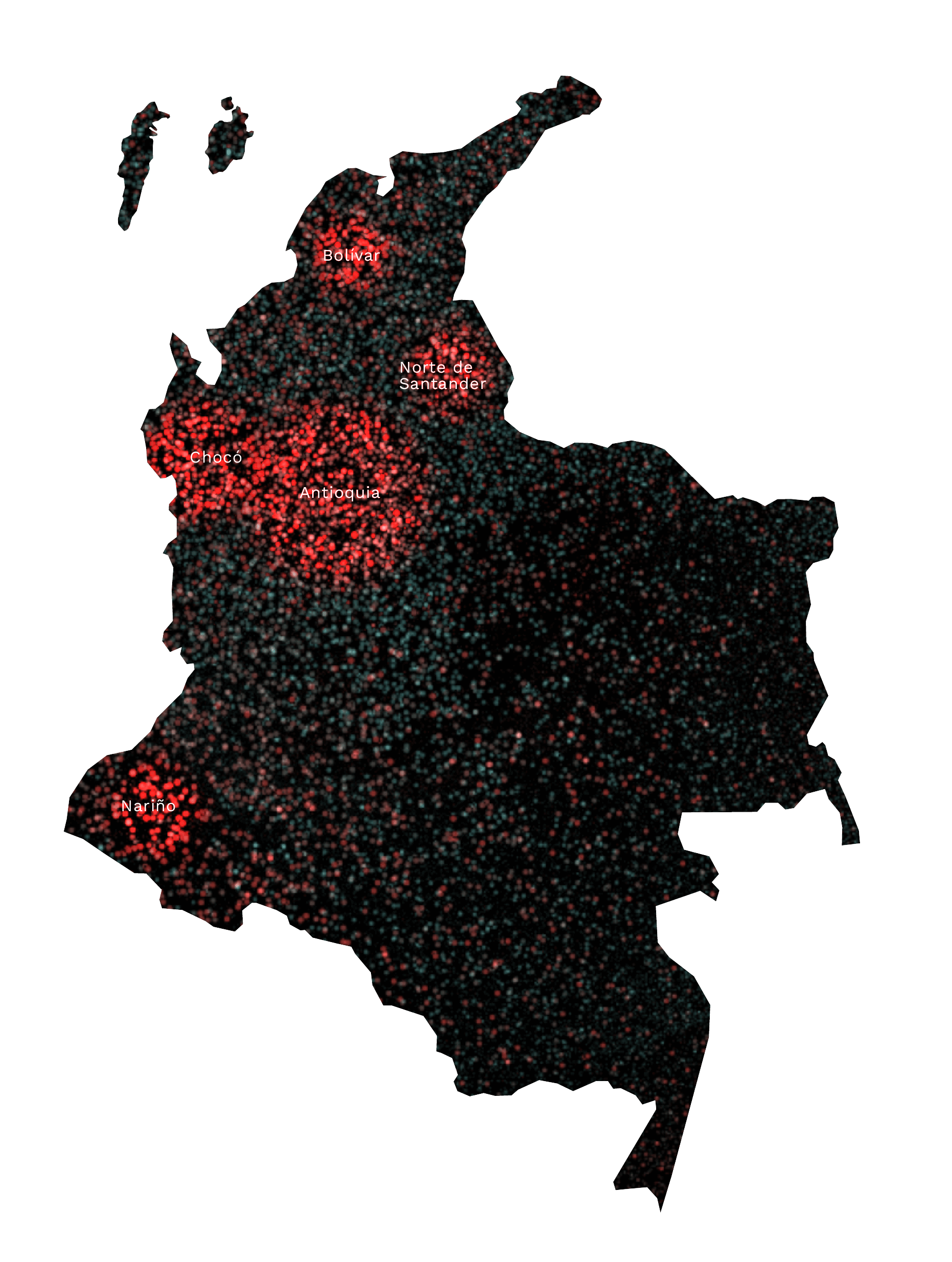
Other regions of the country also require urgent attention. The Pacific coast and the Urabá of Chocó and Antioquia, located Colombia’s northwest region, have constantly appeared in the early warnings of satellite monitoring of hot spots of the Institute of Hydrology, Meteorology and Environmental Studies – IDEAM in the last decade. These areas have proven to be recurrent foci of forest fires, artificially caused to open land for livestock and agriculture. Antioquia, with 390,675 hectares of forest lost in the last two decades, is the fourth department with the greatest deforestation, followed by Chocó, which has lost 253,101 hectares of forest in the last two decades. The latter has been the epicenter of large-scale illegal mining, as well as livestock and agro-industrial expansion, especially in the Bajo Atrato subregion, on the border with Panama and the Urabá of Antioquia. In other departments such as Nariño (196,471 hectares deforested), Norte de Santander (190,997) and Bolívar (162,057), deforestation is associated with the rise of the coca economy and the expansion of illicit crops during the same period.
The latest figures
Esta investigación se fundamenta en datos oficiales recopilados hasta el 2022 por el IDEAM, por ello es importante precisar que en los últimos dos años se ha evidenciado una leve mejoría en las cifras que, no obstante, aún no es decisiva para modificar la tendencia general de pérdida de bosques.
De acuerdo con datos del Ministerio de Ambiente, por primera vez en dos décadas hubo una disminución en las tasas de deforestación en la Amazonía, pasando de 71.185 hectáreas deforestadas en el 2022 a una cifra de 44.274 hectáreas en 2023, lo que supone una reducción del 38 %.
This research is based on official data collected by IDEAM until 2022, so it is important to note that in the last two years there has been a slight improvement in the figures. This, however, is not yet decisive in changing the general trend of forest loss.
According to data from the Ministry of the Environment, for the first time in two decades there was a decrease in deforestation rates in the Amazon, going from 71,185 hectares deforested in 2022 to a figure of 44,274 hectares in 2023, which represents a reduction of 38%.
The Government attributes this achievement to “advances in terms of the peace process and conservation agreements” that are the result of pacts with the FARC dissidents operating in the region. However, this slight improvement is about to shrink noticeably, because the crisis in the dialogues with these illegal groups has once again increased deforestation activity in the Amazon arc with an increase of 41% in the first quarter of 2024, according to the Environment Minister, Susana Muhamad.
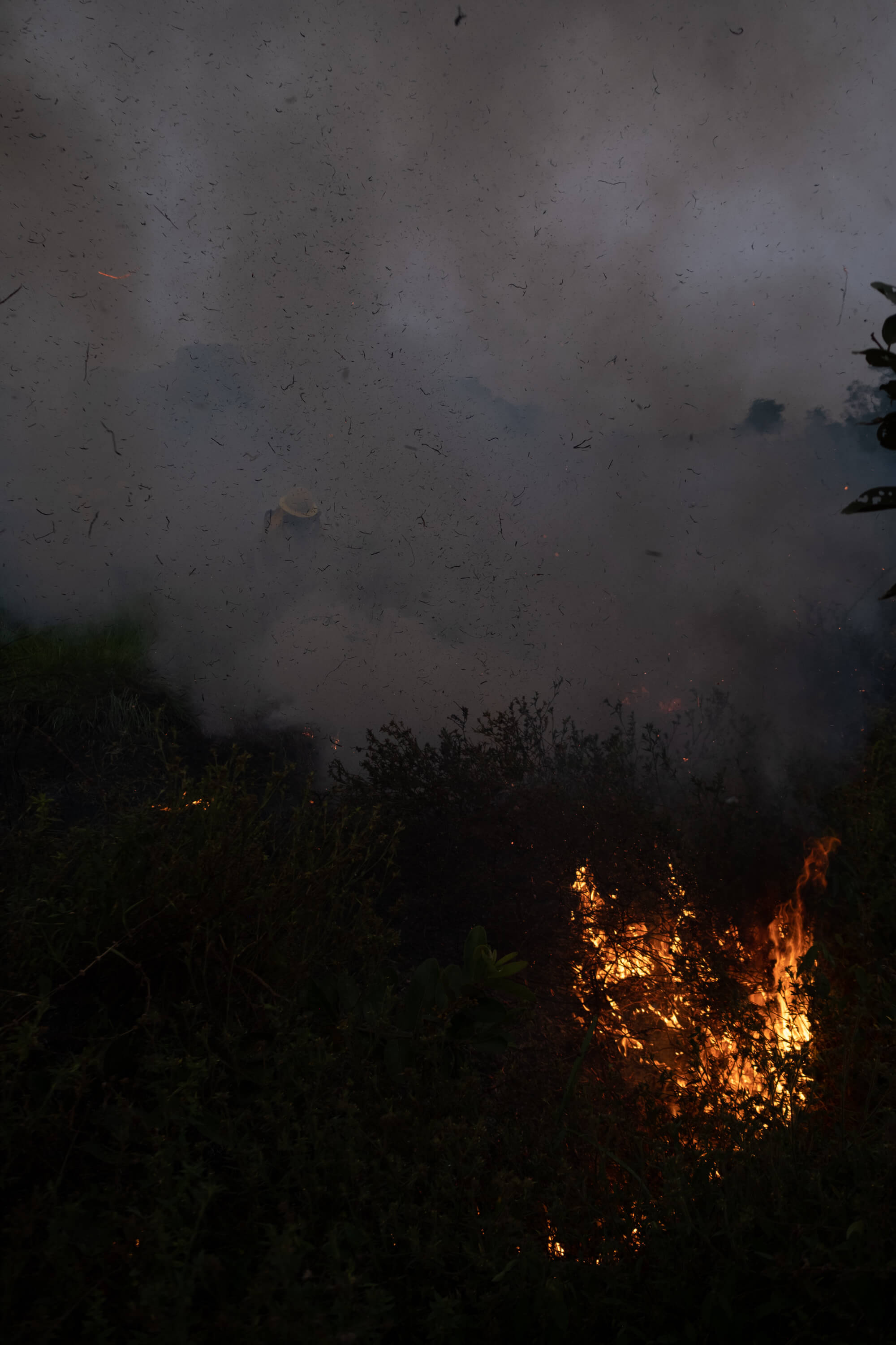
So far this year, the Territorial Environmental Information System for the Colombian Amazon (SIAT-AC) has reported 43,173 hot spots in the Colombian Amazon at the time of publishing this special, on September 25, 2024. These spots generally correspond to forest fires or forest clearings frequently associated with deforestation. The figure has already exceeded last year’s measurements, when 37,839 hot spots were recorded. More than half of these alerts occurred during the dry season in the first three months of 2024, although fires have been reactivated between August and September because of the La Niña phase.
How can we prevent Colombia from progressively losing more of its forests at this rate? Rodrigo Botero, an activist and expert on the subject, states in one of his analyses that the issue must be treated as a State policy, addressing structural problems such as the interference of illegal armed groups in these territories, the role of powerful businessmen and criminals who encourage or directly profit from deforestation, and speculation with land in areas inhabited by marginal communities who find in clearing their land their only form of survival. Solving this equation is the challenge of the future.
151.398 ha
2000 – 2005
118.950 ha
2005 – 2010
66.543 ha
2010 – 2015
138.025 ha
2015 – 2020
91.444 ha
2020 – 2022
Until now, deforestation appears as a situation filling the headlines every time a new road is opened in the Amazonian regions, or when alarms are raised by forest fires whose pollution reach the country’s capital. Botero’s diagnosis is clear: «recovering the forests» implies recovering «long-term governability for the country.»
The data used for the DatArt pieces were processed by Mongabay Latam. You can see the special
“The forests we lost” by clicking here.


